|
Reported Crop Circles for the State
of Colorado -
[Northern] (August 18, 2005)
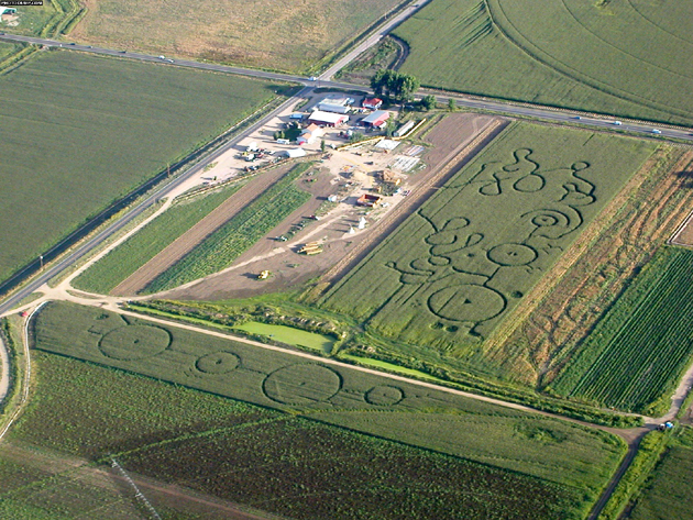
Two adjacent fields of wheat with a series of rings, straight pathways, and ‘squiggly’ lines. The ‘formation’ was identified as a man-made ‘maze’ to attract tourists. This photo was sent to BLT, Inc.

Crop
type: wheat?
Source and photo: BLT, Inc.
|
|
City
/ County / Date:
- King’s Ranch, Alamosa, Alamosa County (September 9, 1967)
- Pueblo, Pueblo County (September 9, 1972)
- La Veta, Huerfanol County (October, 1994)
- Hartman, Prowers County (Heartland?) (June 4, 1996)
- Delta, Delta County
(August 12, 1996)
- Antonito, San Luis Valley / Crestone, Conejos County (September 23, 1996)
- Boulder, Boulder County
(October 4, 2000)
- [Northern] (August 18, 2005)
|


